Finest Hour 126
The Dardanelles and Gallipoli
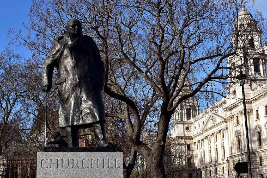
Winston Churchill, Parliament Square, London © Sue Lowry & Magellan PR
July 18, 2013
FINEST HOUR 126, SPRING 2005
BY WILLIAM C. IVES • PHOTOS BY VIRGINIA IVES • MAPS BY SIR MARTIN GILBERT
Mr. Ives is President of The Churchill Centre and, with his wife Virginia, is an inveterate traveler to many corners of the world.
ABSTRACT
THE NARROW CHANNEL between European and Asiatic Turkey was the scene of Winston Churchill’s greatest tragedy. He had never seen these straits. Had he done so, would he have pursued the plan to force the Dardanelles by ships alone?
=====================
The “Dardanelles” hovered as a black cloud in Winston Churchill’s sky for the last half century of his life. The failed attempt to sail a fleet through the Dardanelles Straits, across the Sea of Marmora to cow the Turks into surrendering, and thus relieve Russia in World War I, cast a long shadow.
The controversies generated by that long ago and far away military campaign, which opened in late 1914 and continued in one form or another through 1915, remain unresolved to this day. Was the tactical and strategic planning sound? Was the leadership on the ground and sea up to the task? Was Churchill far-sighted and courageous, or merely obstinate, in pursuing this bold initiative to circumvent the misery and human slaughter of trench warfare on the Western Front by taking Turkey out of World War I? Could the Dardanelles have been forced and neutralized by ships alone?
While there are no consensus answers to these questions, Churchill continues to receive the blame for the campaign’s failure. This was illustrated by the critical comments of a respected professional guide/scholar who accompanied my wife and me on a recent two-day visit to the Gallipoli Peninsula and the Asian shore of the Dardanelles. Needless to say, his comments did not go unchallenged.
The Gallipoli Peninsula projects into the Aegean Sea some 120 miles southwest of Istanbul (Constantinople in 1915), today some four hours away by car—providing one can rise early enough to depart that fascinating city by 6am on weekdays. Gallipoli is not large, measuring roughly fifty miles long and from three to twelve miles wide; its battlefields constitute only a small portion of the whole.
The Dardanelles Straits border Gallipoli on the southwest, separating it from Asiatic Turkey. This historic and militarily vital waterway connects the Aegean Sea with the Sea of Marmora some forty miles to the northeast. Istanbul sits on the north shore of the Marmora, astride the Bosporus, which leads to the Black Sea. The width of the Dardanelles varies from three-quarters of a mile at the “narrows” up to four miles elsewhere.
The military operations on Gallipoli and in the Straits were conducted in a narrowly confined area which can be viewed pretty much in its entirety from several vantage points on the peninsula. Most of the actual battlefields and landing beaches are near roads, and thus quite accessible, while areas of naval operations in the Straits are readily viewable from many locations on both their European and Asiatic shores. Gallipoli and the Dardanelles are visitor-friendly. One should allot at least two full days including travel time to and from Istanbul for a comprehensive visit.
The Dardanelles Campaign opened on 3 November 1914, when the Royal Navy shelled two Turkish forts guarding the Aegean entrance to the Straits: Kumkale on the Asian side, Seddulbahir on the tip of the peninsula. Of course, prior to this, there had been naval activity in the Aegean in the vicinity of the Dardanelles, and much conferencing, strategizing and memorandum exchanging in Whitehall. Churchill’s requisitioning in July 1914 of two new battleships destined for the Turks by British shipyards and already paid for, understandably upset the Turkish Government and provided the Germans with a further opportunity to prod Turkey into entering the war on the side of the Central Powers, which she did at the end of October.
On 13 December, a British submarine sank an old Turkish warship just below Canakkale near the center of the Straits. Another bombardment of the two outer forts occurred on 19 February 1915, and was followed by the sporadic shelling of other forts within the Straits until 16 March. On 18 March, eighteen battleships of the Royal and French navies, plus support vessels, unsuccessfully attempted to blast their way through to the Sea of Marmora.
That failure—and the failure to follow up this attack the next day (or at any other time)—continue to be thoroughly analyzed and heavily criticized. Churchill was at once noticeably displeased by his navy’s lack of aggressiveness and, reportedly, once referred to the commander of the Allied naval forces, Vice Admiral John de Robeck, as Admiral “Row Back.”
The Gallipoli Campaign opened on 25 April 1915, when allied forces under General Sir Ian Hamilton landed on the peninsula at six locations. They were soon stalemated in their efforts to capture the entire peninsula. Months of intense fighting followed, including a major unsuccessful allied offensive in early August. Finally, some 130,000 allied troops, with much of their transport and most of their weapons, were evacuated from Gallipoli in late December and early January, the final departure being on 9 January 1916. The campaign was over.
The Dardanelles, less than a mile wide at the “narrows,” struck me as being a pretty tight fit for any naval armada to pass through while under heavy attack. Today it is one of the world’s busiest waterways: large ships pass through at the rate of one every thirty minutes. From the shore, or from one of the Turkish heavy gun emplacements, these single ships appear to be easy and inviting targets for gun and torpedo alike, especially when moving north (toward Istanbul) against a prevailing 4-knot current, often increased by 1-2 knots because of frequent northeast winds.
Although they were worrisome to those serving on the slow-moving trawlers being used as minesweepers, the primary concern of the allies was not the guns. The chief obstacles were some 350 to 400 mines the Turks had laid in numerous parallel rows perpendicular to the shore just below the “narrows.” And, although mine-sweeping efforts did manage either to dislodge or destroy some mines, it was well known that many remained as of March 18th. More decisively, insofar as the naval thrust on March 18th is concerned, was the legendary (at least for the Turks) sortie by the Turk minelayer Nusret, only ten days before the attack. This single ship, a wooden replica of which lies on the Asiatic shore of the Dardanelles at Canakkale, slipped into the straits and laid between twenty and thirty mines parallel to the Asian shore, below the other minefields. This new minefield was never detected by the allies, and was the one responsible for sinking or seriously damaging three capital ships during the March 18th assault. Their losses persuaded Admiral de Robeck to suspend operations for that day and, as it turned out, for the rest of the war—since the attack was never renewed.
Little note is taken that the Turks had torpedoes and torpedo boats guarding the “narrows” as well as mines. Not many, we are told, and of uncertain effectiveness; but some were available. Yet while several of the torpedo tubes were rendered inoperative by allied shelling, even one or two successful hits could have been quite disruptive to an invading fleet in narrow waters.
Churchill had never seen these Straits.’ Had he done so, I cannot help wondering whether he would have concluded that on 18 March 1915, the naval force as then constituted, facing the defenses it faced, could have successfully fought its way through to the Sea of Marmora. No doubt some ships could have made it—but would those have been enough to have achieved the goal of reaching Constantinople and knocking Turkey out of the war? These and the many related questions will long be debated by scholars, and those of us who relish a good argument.
On Gallipoli itself the five British landing beaches (S, V, W, X, Y) and the beach at ANZAC (Australian New Zealand Army Corps) Cove, the most widely recognized one, were pitifully small and provided the Turks with excellent fields of fire. Most fortunately for the allied forces, several of these beaches were not seriously defended. Examples include Y Beach, really no beach at all with 200-foot cliffs immediately behind it; and X Beach, less than 100 yards long and narrow. W Beach, the only landing site that resembles a beach, is a quarter-mile long and somewhat open to the front. It was heavily defended, as was V Beach, where the main
landing forces came ashore. V Beach is narrow and nearly 1000 feet long, set in saucer-like terrain between forts at each end. The British suffered heavy casualties here.
ANZAC Cove is a short, narrow beach surrounded by steep, high cliffs, although erosion has narrowed it somewhat since 1915. It was lightly defended. The much longer and broader adjacent “Brighton Beach,” where the ANZAC was supposed to have landed, was far more heavily defended. It remains unclear whether the ANZAC Cove landing was intentional to avoid those defenses, or the result of other factors.
Gallipoli is beautiful, serene, unspoiled and relatively undeveloped, with few tourist facilities and little commercialization. Olive trees are abundant, but few other crops. Rugged, scrub-covered ravines, gulleys and ridges mark the landscape, providing defenders with a huge advantage, making it less than an ideal invasion site. There are few but adequate roads and many paths.
Visitors, except around April 25th, the anniversary of the landings, do not flock to Gallipoli. Most are from Australia and New Zealand, very few from America. An active military reservation covers a large part of the northern half of the peninsula, while a national park protects the southern portion, where most of the battlefields are located. From the challenging heights of Achi Baba in the south central and Chunuk Bair in the center—both primary (but unattained) objectives of the Allied invasion—one can clearly view the placid Aegean and the Dardanelles, as well as the contested areas. Alan Moorehead, in his excellent mid-Fifties book, Gallipoli, refers to this view as “perhaps the grandest spectacle of the whole Mediterranean.”
Memorials and well-tended cemeteries are found everywhere throughout the battlefields. The most imposing is the huge Turkish memorial at the southern tip of the peninsula, which is clearly visible from the ruins of ancient Troy, some ten miles away across the mouth of the Dardanelles. Each of the major allies has its own impressive memorial, situated where that country’s forces conducted significant military operations.
I was advised that there are over seventy cemeteries (both Turkish and Allied) containing the remains of from a few to hundreds of those who perished in 1915. Estimates of casualties (dead, sick, wounded and missing) vary widely and, while these large discrepancies can never be fully resolved, many believe at least 530,000 (280,000 Turkish, 250,000 allied) with up to 150,000 dead or missing to be a reasonable estimate. Whatever the numbers, some very serious fighting took place here. The last British survivor of the campaign died in 2001; the last Australian in 2002.
Throughout the contested areas stand disproportionately large black statues depicting various feats of arms and compassionate or heroic acts. Quite often sheer size is equated with importance and even pride, and the Turks have every right to be proud of their defense of Gallipoli and the Dardanelles. After all, it was their most notable military success during the entire war. Nevertheless, it can be disconcerting suddenly to come upon these outsized figures, looming high above the vegetation
within the tight confines of the battlefields.
The battlefields themselves are small, more of a U.S. Civil War size than many of those of the two World Wars. For example, it has been estimated that the ANZAC forces during the first three months never controlled an area exceeding 400 acres within a perimeter of two kilometers.
Not only was the fighting vicious; it was close and personal. Opposing trenches, of which a few are still clearly visible (some have been reconstructed), were sometimes no more than thirty or forty feet apart. Bayonets were often the weapons of choice. Thousands of hand-made grenades were lobbed back and forth. Small plots of ground changed hands many times. Millions of rifle rounds were expended. The intensity of this close order combat is graphically displayed in a small case in the Gaba Tepe Information Centre. There are found several bullets embedded in other bullets: Turkish in Allied, Allied in Turkish. These violent collisions testify to the withering fire that was exchanged.
Although Churchill was not at Gallipoli, others of note were: Captain Clement Attlee for one and Churchill’s younger brother Jack for another. Churchill had arranged for Major Jack Churchill to serve on Ian Hamilton’s staff, which permitted him to observe at close hand various military operations. He also penned the following ditty:
“Y Beach,” The Scottish Borderer cried,
while panting up the steep hillside.
Y Beach! To call this thing a beach is stiff;
it’s nothing but a bloody cliff.
Why Beach?
Perhaps not quite the Churchillian literary style we are accustomed to, but it does make the point.
And on the Turkish side were Lt. Colonel (later Colonel) Kemal Ataturk, who led a determined Turkish defense and was destined to become the “father” of modern Turkey, and Ataturk’s successor as President, Ismet Inonii.
As a committed Churchillian, unassailable objectivity regarding the Dardanelles is for me probably not possible. Nevertheless, after spending substantial time with the literature and at the site, I have reached the conclusion that Churchill is, on balance, more blameless than blameworthy tor the campaign’s tactical failures, and certainly deserves far more credit than discredit for its strategic vision.
This visit to an area of considerable historical importance—both ancient and modern—was highly rewarding. Without the slightest hesitation, I strongly recommend it. But it would be best to schedule your trip between April 1st and October 31st, when the climate is at its best.
======================
Note 1: Martin Gilbert tells us that Churchill visited Smyrna (Izmir) on the Mediterranean in 1910 (see Craig Encer’s article this issue), but evidently not the Dardanelles; and that when he passed through the Dardanelles on the night of 4 August 1959, aboard Onassis’s yacht Christina, he never saw the Straits. The passage was made deliberately after he had gone to bed so as not to upset him. Gilbert, Churchill: A Life, p. 219; and Winston S. Churchill, vol. 8, pp. 1297-98


Subscribe
WANT MORE?
Get the Churchill Bulletin delivered to your inbox once a month.